National Park, Milwaukee
National Park covers 2.6 square miles of Milwaukee, and about 8,558 people live here. This page maps 63 parks and public places and 32 businesses inside its lines, most of them Food and Drink.

National Park In Pictures
Parks, landmarks and local spots inside these lines. Tap a photo to open its page.
 Knitting Factory Lofts
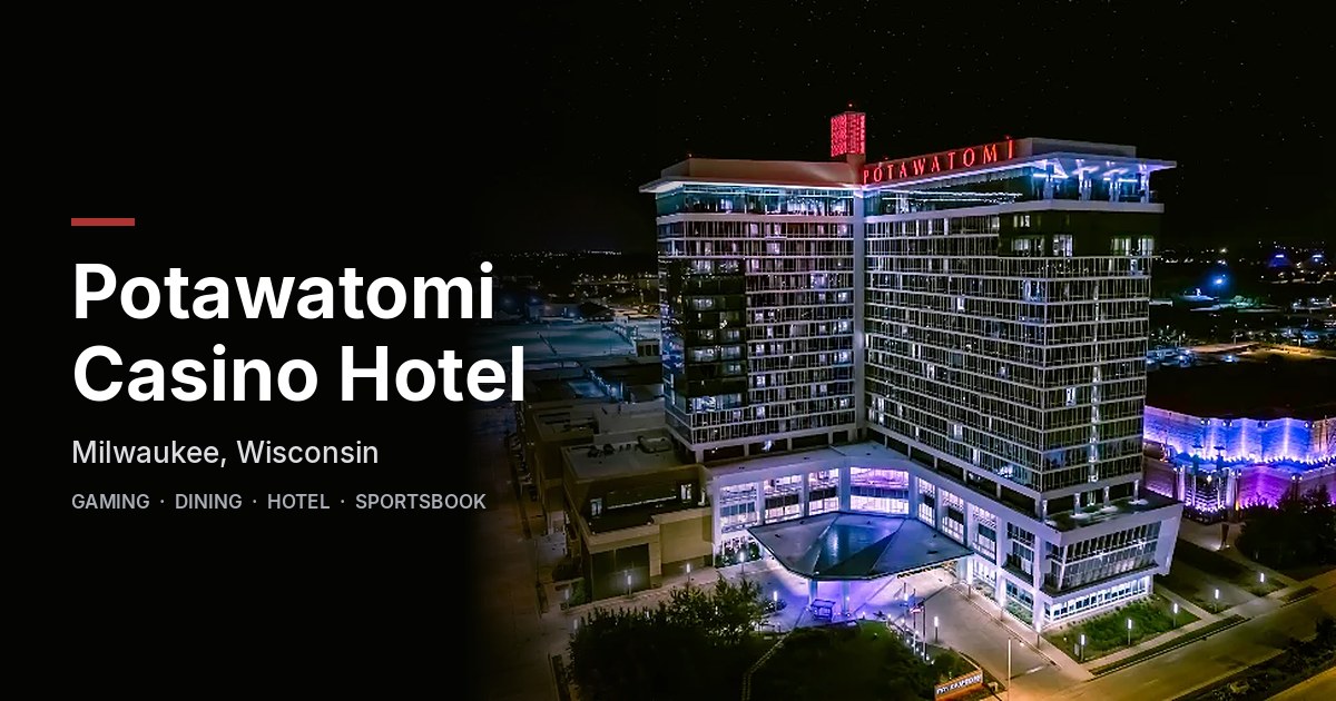 Potawatomi Casino & Hotel
 Mitchell Park Horticultural Conservatory
 Mitchell Park Domes Horticulture Conservatory
 Northwestern Branch National Home For Disabled Volunteer Soldiers
 Twisted Fisherman
 Soldiers' Home Reef
 Familia Dental
 Walk of Fame
 Miller & Miller Law, LLC
 Ward Memorial Hall
 Mitchell Park
Living In National Park
National Park has about 8,558 people on 2.6 square miles, 3,348 per square mile, more spread out than Milwaukee as a whole (5,683).
The median household earns $45,600 a year, 16% below the city median, #93 of 143 neighborhoods.
74% of homes are rented, and the median rent is $965 a month.
It is an older part of town: 73% of homes were built before 1960.
People here skew older, with a median age of 36 against 32 citywide.
10% of workers take transit to work, against 5% across Milwaukee.
84% of homes have broadband internet.
Inside its lines: 16 landmarks and historic sites, 9 parks, 9 trails and bike paths, 8 clinics and 9 places to eat.
People
Money And Work
Housing
Getting Around
Connected
US Census Bureau American Community Survey 2020 to 2024, added up from the census tracts in National Park. Ranks count neighborhoods with 500 or more people.
Parks, Schools And Public Places In National Park
Landmarks And Historic Sites 16
- Knitting Factory Lofts2100 West Pierce Street, Milwaukee, WI 53204
- Northwestern Branch National Home For Disabled Volunteer Soldiers
- Soldiers' Home Reef
- Walk of Fame
- Ward Memorial Hall
- 1635 Building1635 West Saint Paul Avenue, Milwaukee, WI 53233-2644
- Allied Insulation Supply Company315 North 12th Street, Milwaukee, WI 53233
- Hank Aaron's 755th Home Run Plaque
- James E. Groppi Unity Bridge
- Milwaukee Road Boulder
- Paper Box Lofts1560 West Pierce Street, Milwaukee, WI 53204
- Power House
4 more on the map below
Parks 9
- Mitchell Park Horticultural Conservatory524 South Layton Boulevard, Milwaukee, WI 53215
- Clarke Square Park2330 West Vieau Place, Milwaukee, WI 53204
- Desert Dome
- Menomonee Valley Bioretention Facility2600 West Canal Street, Milwaukee, WI 53233
- Menomonee Valley Community Park212 South 36th Street, Milwaukee, WI 53215
- Mitchell Park524 South Layton Boulevard, Milwaukee, WI 53204
- Show Dome
- Three Bridges Park400 South Layton Boulevard, Milwaukee, WI 53215
- Tropical Dome
Trails And Bike Paths 9
- Chickadee Trail
- Hank Aaron State Trail
- Hank Aaron State Trail Harley Loop
- Hank Aaron State Trail River Loop
- Hank Aaron State Trail Sigma Loop
- Killdeer Hill
- North Bank Trail
- Oak Leaf - Hank Aaron Trail Connector
- Paso de la Rama
Clinics 8
- Building 70-A
- Building 70-B
- Building 70-C
- Building 70-D
- Building 70-E
- Education Center
- Spinal Cord Injury Center
- Zablocki Integrated Health Program
Places Of Worship 8
 Christ Evangelical Lutheran Church2235 West Greenfield Avenue, Milwaukee, WI 53204-1910
- Ascension Lutheran Church1236 South Layton Boulevard, Milwaukee, WI
- Iglesia Apostólica Nueva Vida2427 West National Avenue, Milwaukee, WI 53204
- Iglesia Cristiana Casa de Dios2935 West Greenfield Avenue, Milwaukee, WI 53215
- Iglesia De Dios Pentecostal Príncipe De Paz
- Life Restoration Church2422 West National Avenue, Milwaukee, WI 53204
- Prince of Peace Catholic Church1126 South 25th Street, Milwaukee, WI 53204-1940
- St. Lawrence Roman Catholic Church1434 South Layton Boulevard, Milwaukee, WI
Sports Fields 7
 American Family Field1 Brewers Way, Milwaukee, WI 53214
 Helfaer Field
 Valley Fields1818 West Canal Street, Milwaukee, WI 53233
- Four Seasons Skatepark200 North 25th Street, Milwaukee, WI 53233
- Journey House Packers Field
- Shimek Track
- Shimek Track & Field Facility
Schools 3
- Doerfler Elementary School3014 West Scott Street, Milwaukee, WI 53215
- Mother Caroline Campus1418 South Layton Boulevard, Milwaukee, WI 53215-1923
- Prince of Peace School - 25th Street Campus1114 South 25th Street, Milwaukee, WI 53204-1940
Fire Stations 1
- Milwaukee Fire Station 261140 South 26th Street, Milwaukee, WI 53204
Hospitals 1
- Clement J. Zablocki Veterans Affairs Medical Center5000 West National Avenue, Milwaukee, 53295
Post Offices 1
- VA Hospital Post Office5000 West National Avenue, Milwaukee, WI 53295-0001
Places To Go In National Park
The most reviewed spots inside these lines, with photos where they have one.
Top Attractions And Things To Do
Mitchell Park Domes Horticulture ConservatoryBotanical garden in National Park4.7 stars, 7,403 reviewsMitchell ParkPark in National Park4.7 stars, 951 reviews Three Bridges ParkPark in National Park4.6 stars, 339 reviews
 Urban Ecology Center - Menomonee Valley / Silver CityCommunity center in National Park4.8 stars, 237 reviews
Parks, Beaches, Museums And Landmarks
Mitchell Park Horticultural ConservatoryPark in National ParkKnitting Factory LoftsLandmark in National ParkNorthwestern Branch National Home For Disabled Volunteer SoldiersLandmark in National ParkSoldiers' Home ReefLandmark in National ParkWalk of FameLandmark in National ParkWard Memorial HallLandmark in National ParkWhere To Eat
Twisted FishermanSeafood restaurant in National Park4.3 stars, 1,771 reviews Screamin' Sicilian PizzaFrozen food manufacturer in National Park3.5 stars, 616 reviews
 RuYi Asian KitchenAsian restaurant in National Park3.7 stars, 318 reviews
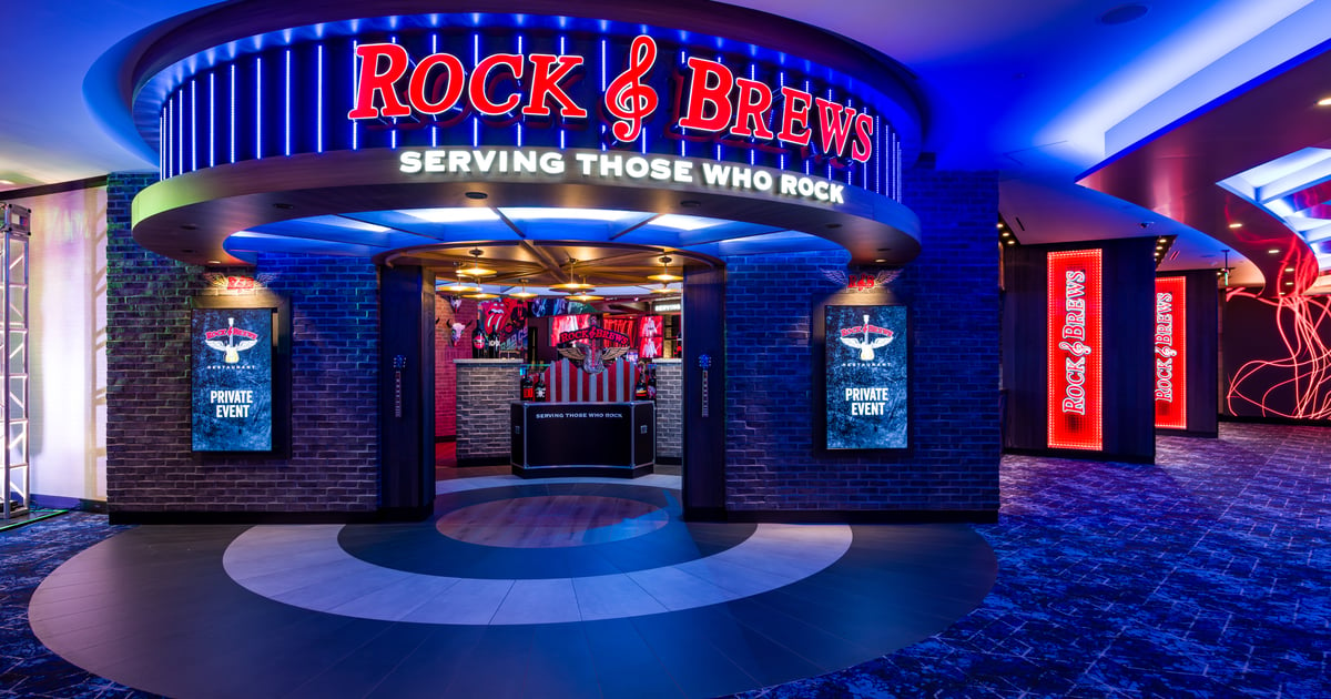 Rock & Brews Potawatomi MKEAmerican restaurant in National Park2.4 stars, 278 reviewsDream Dance SteakhouseSteak house in National Park3.9 stars, 237 reviews
Bars And Nightlife
Businesses In National Park
Is yours missing or wrong? List or fix it free.
Food and Drink 9
- Twisted FishermanSeafood restaurant
- Screamin' Sicilian PizzaFrozen food manufacturer
- RuYi Asian KitchenAsian restaurant
- Rock & Brews Potawatomi MKEAmerican restaurant
- Dream Dance SteakhouseSteak house
- McDonald'sFast food restaurant
- Villa's Mexican RestaurantMexican restaurant
- La Fondita de MilwaukeeMexican restaurant
- Honeydip DonutsDonut shop
Parks and Recreation 6
- Mitchell Park Domes Horticulture ConservatoryBotanical garden
- Mitchell ParkPark
- Three Bridges ParkPark
- Urban Ecology Center - Menomonee Valley / Silver CityCommunity center
- American Family FieldStadium
- Milwaukee Brewers Baseball ClubBaseball club
Shopping 4
 Antiques on PierceAntique store
 BBC LightingLighting store
 Value Village | National ParkSecond hand store
- Brewers Team Store™Sports memorabilia store
Bars and Nightlife 3
 Great Lakes Distillery & Tasting RoomDistillery
- Oscar's Pub & GrillBar & grill
- Third Space BrewingBrewery
Professional Services 2
 Hatch Staffing ServicesEmployment agency
- Blue Kangaroo Coin LaundryLaundromat
Lodging 1
- Potawatomi Casino & HotelCasino hotel
Health and Medical 1
- Familia DentalDental clinic
Legal 1
- Miller & Miller Law, LLCBankruptcy attorney
Finance and Insurance 1
- Check `n GoLoan agency
Moving and Storage 1
- Extra Space StorageSelf-storage facility
Home Services 1
 Molly Maid of East Metro Milwaukee and RacineHouse cleaning service
Beauty and Personal Care 1
- Beautary Nails SpaNail salon
Real Estate 1
Renosy by Renters WarehouseProperty management company
Own A Business In Milwaukee
List it free on your neighborhood page in about two minutes. Townstoop is built by Clickflame, building local business sites since 2004.
National Park Questions
How many people live in National Park
About 8,558, from the Census American Community Survey tracts inside the National Park lines.
What parks are in National Park
9 mapped, including Clarke Square Park, Desert Dome, Menomonee Valley Bioretention Facility, Menomonee Valley Community Park.
How many schools are in National Park
3 schools are mapped inside the neighborhood.
What is the rent like in National Park
The Census median gross rent is $965 a month, against $1,059 for all of Milwaukee.
Do people rent or own in National Park
74% of homes are rented and 26% are owned, against 58% rented across Milwaukee.
How do people get to work from National Park
The average commute is 21 minutes. 59% drive alone, 10% take transit, 4% walk and 10% work from home.
How old are the homes in National Park
73% were built before 1960 and 7% in 2010 or later. 24% are single family homes.
Is National Park a family neighborhood
31% of households have children and 28% of residents are under 18. 14% are 65 or older.
Sources, Census figures from the US Census Bureau American Community Survey five year estimates, parks, schools and public places from OpenStreetMap contributors (ODbL). How we build these pages.